vperspec
Vertical Perspective Azimuthal Projection
Classification
Azimuthal
Identifier
vperspec
Graticule
The graticule described is for a polar aspect.
Meridians: Equally spaced straight lines intersecting at the central pole. The angles displayed are true angles between meridians.
Parallels: Unequally spaced circles centered on the central pole. Spacing decreases away from this pole. The opposite hemisphere cannot be shown, nor can distant parts of the closer hemisphere. The limit of visibility depends on the observation altitude.
Poles: The central pole is a point. The other pole is not shown.
Symmetry: About any meridian.
Features
This is a perspective projection on a plane tangent at the center point from a finite distance. Scale is true only at the center point, and is constant in the circumferential direction along any circle having the center point as its center. Distortion increases rapidly away from the center point, the only point which is distortion free. This projection is neither conformal nor equal area.
Remarks
This projection provides views of the globe resembling those seen from a spacecraft in orbit. The Orthographic projection is a limiting form with the observer at an infinite distance.
This projection requires a view altitude parameter, which specifies the observer's altitude above the origin point. Because this parameter is unique to this projection and because the projection does not need any standard parallels, a special workaround is used. Rather than add an extra
axesm-based map property just forvperspec, theMapParallelsproperty is repurposed instead. You should assign the desired view altitude value to theMapParallelsproperty. Provide a scalar value for length in the same units as the earth radius or semi-major axis length used in theaxesm-based map reference ellipsoid ('Geoid') property.This implementation of the vertical perspective azimuthal projection is applicable only for coordinates that are referenced to a sphere.
Limitations
Data more distant than the limit of visibility is trimmed.
Example
landareas = shaperead('landareas.shp','UseGeoCoords',true);
axesm ('vperspec', 'Frame', 'on', 'Grid', 'on');
geoshow(landareas,'FaceColor',[1 1 .5],'EdgeColor',[.6 .6 .6]);
tissot;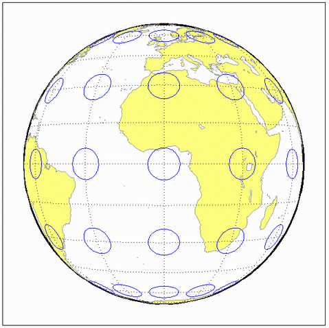
Version History
Introduced before R2006a