wmzoom
(To be removed) Set or obtain zoom level of web map
The wmzoom function will be removed in a future release. Use a
geographic axes object and the ZoomLevel property of the object instead. For
information on updating your code, see Version History.
Description
wmzoom( specifies the zoom
level of the current web map, zoomLevel)zoomLevel. If there is no
current web map, wmzoom creates a new web map.
zoomLevelOut = wmzoom()
zoomLevelOut = wmzoom(wm)wm.
Examples
Display a marker on a web map.
wmmarker(51,0)
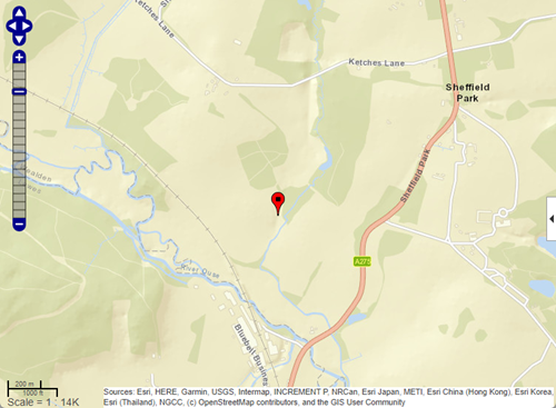
Query the zoom level of the current web map.
zoomLevelOut = wmzoom()
zoomLevelOut =
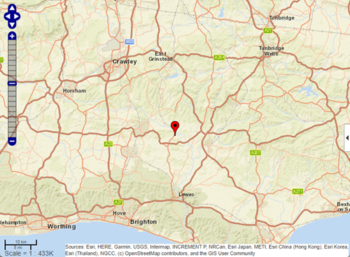
15Zoom out by specifying a new zoom level.
wmzoom(10)
Input Arguments
Output Arguments
Tips
Particular maps may not support every available zoom level. If your map displays as completely white, try another zoom level. The map you are displaying may not support the zoom level you have currently selected. You can also select another base layer, which might support the specified zoom level.
Version History
Introduced in R2013bSee Also
1 Alignment of boundaries and region labels are a presentation of the feature provided by the data vendors and do not imply endorsement by MathWorks®.